The current article is an overview about the changes that occurred in the skobbler navigation app for iOS platform in time and the current features set, high level architecture and the innovations introduced with the 5.0 version, which is available on the App Store since December 2013.
This product was first launched on the iOS market in October 2009. At that point in time, skobbler was the first one to use map data powered by OpenStreetMap, a small community of enthusiasts striving to change the whole approach on maps. The app delivered turn-by-turn navigation and audiovisual advisory, based on permanent internet connection.
After almost two years of regular updates and improvements, the product got to 1,5 million users. But this wasn"t enough. Beyond delivering quality on present features, something else needed to be changed. Focusing on our users" needs led to adding the offline functionality and switching the user experience completely with a new design approach.
The new product was shipped on the market in October 2011. It was the industry"s first universal, online-offline ("hybrid") navigation app for iPhones and 3G-equipped iPads.
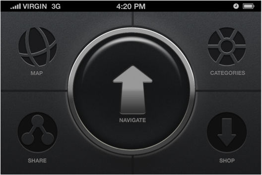
The main focus was on the user. We intended to solve traveling issues regarding regular navigation apps that required roaming costs and huge downloads. And we wanted to deliver that through a clean interface that goes beyond form straight to intuitive function. A skeuomorphic but minimal design that took into account the driving context of navigation (with avoidance of small UI elements) was the proper solution.

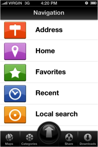
For changing the UI of the app we did have more samples in the first place. One of the designs was more focused on the traditional style of navigation apps and was similar to the previous app"s menu. The second one took a completely new approach of the used color schemes and positioning of the buttons.
In the first place we tested the app internally. The user experience feed-back received from the team helped to insert some improvements in the final app.

After weeks of development and testing the final app hit the market. The new UI doubled our number of downloads on the App Store in the first weeks after the release.

The new update of GPS Nav 5.0 was released in December 2013. GPS Nav delivers the most versatile voice-guided turn-by-turn navigation product and integrates new styles and Tripadvisor feature. It is a standalone iOS application with four and a half star ratings on the German App Store and over four million users.
Equipped with iOS SDK that provides the mapping and navigation functionalities, the application uses skobller own maps (known also as OSM+ maps) based on OSM map data. The data extracted from OSM goes through the improvement processes and it is compiled into skobbler own map format.
The feature set of the current version include the following:
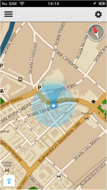
Map styles - customizable map styles allows users to change the "skin" of the map depending on the weather or timing conditions. The available map styles are the day - night style, gray scale and outdoor styles. For the navigation mode there is an additional speedcam style used to warn the users of a potential mobile or fixed speedcam.
Offline functionality - The application provides the option to purchase and download map packages for countries and cities ensuring that the users have map display, routing, navigation and search functionalities without an Internet connection.

Search - being used in both online and offline modes, the search done with an internet connection uses the Apple service for address searches and the Tripadvisor and skobbler"s own category search for POI"s. Without a connection, search relies on skobbler services such as the multi step search for address searches and the category search for POI"s.
Travel guide - Based on Wikitravel content, the users have access to articles about countries, cities, interesting facts and POI"s displayed on the map. Individual articles are available both in online and offline mode.

Navigation and free-drive mode - Navigation can be started on an already calculated car route, providing the user information about the distance to destination, the estimated time to destination, street names, turns and distances, audio advices, current speed, speed limit and speed warnings.
The free drive mode should be used when there is no specific destination to which the user navigates. It provides map display in 2D and 3D mode, speedcam detection and information about current street the user navigates on.
Speedcam - the data for speedcam detection is up to date, the static speedcams databases are updated on daily bases, the mobile speedcam databases are updated every five minutes. The service to detect static speedcams is free of charge; the mobile speedcam detection services can be purchased through In-App purchases.
FCD (floating car data) - the app used on a daily basis by millions of users, collects a significant amount of floating car data. The information related to road networks, speed, directions, travel time is used to further improve the OSM+ maps. The Floating Car Data collected by the GPS Nav is close to seven million driven kilometers per day.

GPS Navigation application is based on skobbler"s NGx technology and iOS SDK. The current section provides an overview about the project architecture and components.
OSM+ - provides the map data required for map rendering, routing and navigation
Core component - a cross platform C++ component responsible for map rendering (OpenGL), routing, navigation, searches.
iOS SDK - an objective C++ layer (similar to the MapKit framework provided by Apple). It ensures the integration of the feature set supported by the Core component into any native iOS application.